top of page

Precision Surveying with the Zenmuse P1 Camera

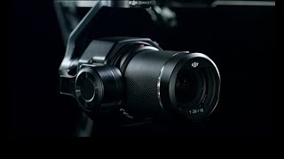
We are excited to share a significant recent enhancement to our drone surveying and mapping services: the revolutionary Zenmuse P1 camera! This cutting-edge camera is transforming the world of aerial surveying, enabling high quality survey grade accuracy and capable of producing high quality photogrammetric models such as those shown below.


Improving on our DJI P4RTK aerial surveying platform, the M300RTK-mounted P1's full-frame 45-megapixel sensor is perfectly suited to photogrammetry, enabling the generation of detailed 3D models and orthomosaic maps with remarkable accuracy. By incorporating this state-of-the-art technology into our services, we are confident that we can assist our architectural, engineering and 3D modelling clients deliver the highest quality surveying and mapping results.


Screenshot of photogrammetric 3D model created from Images shot from Drone-mounted DJI Zenmuse P1 Survey Camera
Screenshot of 3d Model 80m flight altitude; GSD 1cm/pixel


Featured Posts

Recent Posts

Archive

Search By Tags

No tags yet.

Follow Us

  • Facebook Social Icon
  • Twitter Social Icon
  • YouTube Social  Icon

ABOUT US

CONTACT

Elevated Imaging Systems is fully equipped, trained, CAA-approved and insured to provide professional aerial 

drone/UAV Ultra High Definition (up to 6K Raw) video and photography to meet a broad range of commercial and personal requirements. These include construction and land surveys, marketing and advertising, sporting events and much more.

Our Location:

Elevated Imaging Systems

3 Wellington Park Belfast, BT9 6DJ


Tel:

079 8086 2536


Email:

contact@elevatedimaging.systems

Join our mailing list

Never miss an update

RECENT NEWS

OUR NETWORK

  • Facebook Social Icon
  • Twitter Social Icon
  • YouTube Social  Icon
  • Vimeo Social Icon
Aerial Drone Photography Belfast

© Elevated Imaging Systems 2017. All Rights Reserved.

bottom of page